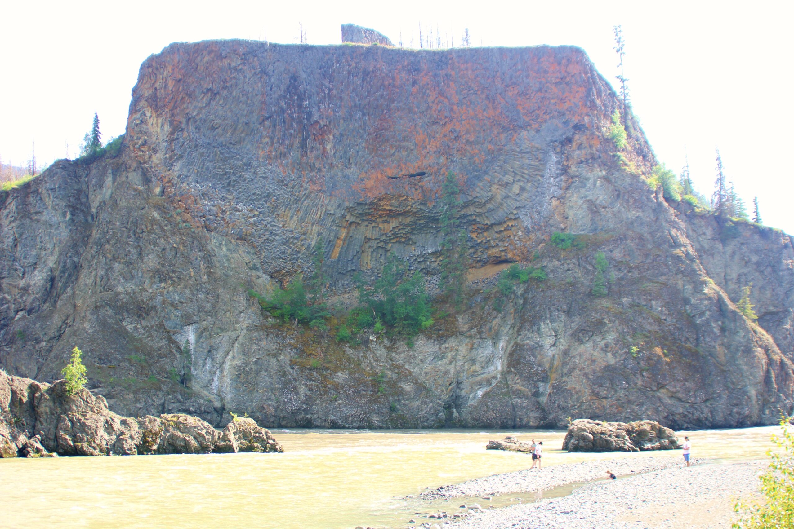
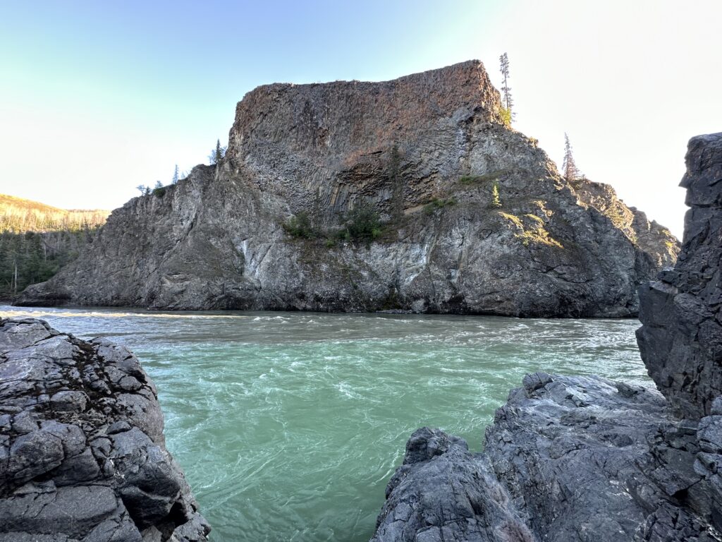
Tsadu, the Number 1 Most Photographed Rock Formation in the Tahltan Highlands
Tsadu, a striking basaltic rock formation marking the point where the Tahltan River enters the Stikine River is likely the most photographed and iconic natural symbol of the Tahltan Nation of northwestern BC.
A Legend in Stone
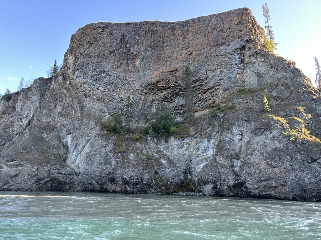
Many see a large bird in the pattern of basalt columns across its face. I have been told by some whose ancestors have long inhabited this area that it is referred to as “tseskiye chō kime” or big crow (raven)’s house.
But a number of elders have told me a different legend of the impressive formation.
They tell me this was formed when the Tahltans were under siege from coastal invaders who travelled up the Stikine by canoe. They point to another large rock formation on the opposite side of the valley that represents the guardian who came to their rescue, throwing the canoe with all its occupants against the rock across from the mouth of the Tahltan River, permanently setting them in stone for all to see as they pass by.
So, according to this narrative, it is not a large bird with outspread wings you are looking at, but a long canoe full of warriors, permanently imprisoned in the rock. It’s not hard to see when you know what you’re observing!
The Big Crow
I need to stop on another trip in to take a few more shots. Some of the elders have told me that tseskiye chō is the rock formation on the other side, the one who threw the invaders into the rock where they remain trapped to this day.
There is no direct distinction between crows and ravens in the Tahtlan language as there is in English. The smaller of the two is called tseskiye, but so is the larger. Sometimes the distinction is made by referring to the raven as “tsekiye chō” or “big crow.” But in reality, the common crow that is so well-known in the south is seldom seen this far north, making the distinction moot.
A Symbol of Life
Not only is the impressive natural monument known as Tsadu representative of something that happened eons ago in the dim fog of time that perhaps spared the lives of the residents of the region, but it also continues to mark a source of life that has been such for as long as anyone can remember.
Tsadu towers above the point where the Tahltan River enters the Stikine River.
For centuries the Tahltan people have come to this place to fish. This marks the place where all the salmon from the coast make the turn to their spawning grounds, eventually reaching Tahltan Lake where they finish their journey (and provide feed for countless grizzly bears).
Worth the Trip
Tsadu and the surrounding landscape are definitely worth the trip this far along the Telegraph Creek Road (BC Highway 51). Apart from the famous natural monument, the drive through the boreal forest from Dease Lake is spectacular.
Telegraph Creek Road starts at the turnoff from BC Highway 37 at the gas station and store in Dease Lake. The elevation of Dease Lake, right at the top of the Arctic Divide, is 806.6 m (2,646 ft). From there the road runs out past the airport, then along the Tanzilla River and into the wilderness.
The constantly changing terrain then takes you across Moose Horn Swamp, past Caribou Camp, through “The Burn” where the road runs for miles in a straight line, then begins to drop down into canyon country. Steep hills, narrow roads, and spectacular scenery provide both thrills and breathtaking views. As I’ve heard more than once from visitors to the area, “Nothing you could have told me would have prepared me for that road!!”
The Rest Stop
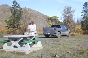
Be sure to stop at the second rest stop on the way in (the first one is at the start of “The Burn”). This will give you a great opportunity to stretch your legs and to get a good view of part of the Grand Canyon of the Stikine.
From there, the road drops down on the way past the Lava Beds (accessible via a road that isn’t designed for cars or RVs). Watch the canyon walls along the Tahltan River for mountain goats!
Just a minute or so later, you’ll find yourself driving along the narrow volcanic wall that divides the Stikine River on your left from the Tahltan River on your right. You might be tempted to stop if you can find a spot and take a walk on the rugged surface. But be warned! It is very treacherous walking, with numerous holes in the moss-covered lava to grab your feet and potentially cause serious injury.
If you do happen to attempt a short walk, be sure to treat the land with great respect. You are walking in the Tahltan Highlands, and this is sacred territory.
Dangerous Hill
At one time, the road was much narrower at the 180-degree turn that suddenly plunged you down toward the Tahltan River. There used to be a sign at the narrow corner that simply said “Dangerous Hill.” Now that Telegraph Creek Road is officially BC Highway 51, there are less dramatic and official government signs advising the percentage of the incline. But just the same, it is still quite a hill and, like many other places along the road, must be taken carefully and watchfully. It is best to choose a lower gear at the top, rather than riding your brakes all the way down.
Once you cross the bridge, you are entering Tahltan Fish Camp, right at the mouth of the Tahltan River and across from Tsadu.
Remember that you are guests in the Tahltan Nation and enjoy your visit!